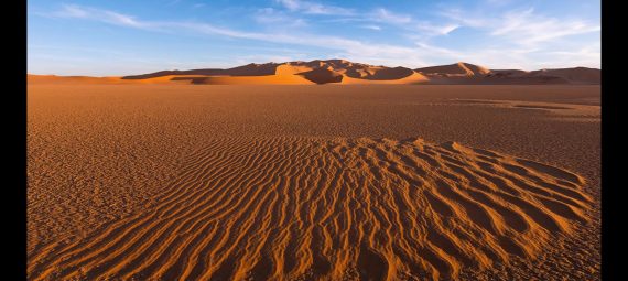
The Sahara is the largest sandy area on the globe, stretching in North Africa from the Red Sea to the Atlantic for almost five thousand kilometers. Dunes reaching a height of 300 meters, many kilometers of perfectly flat areas of saline soil, lush oases and endless dunes stretching beyond the horizon — all this makes up one of the most amazing landscapes of the planet. However, despite the area of more than 8 million km, the Sahara is not so easy to visit, which is due to the extremely turbulent political situation in the region. However, at least out of the corner of your eye you can still look at the grandeur of the desert — the main thing is to know where and when to go.
The Sahara almost completely covers the area of North Africa from the Mediterranean Sea to 16 ° north latitude, with the exception of a rather narrow coastline of the continent, characterized by lush vegetation. Its area is 8.6 million km, which is about a third of the total area of the African continent. From west to east, the desert stretches for 4800 km, and from north to south its length is from 800 to 1200 km.
Contrary to popular belief, the Sahara is not only sand dunes and rare oases. The landscape here is no less diverse than in other natural areas: there are rocky plateaus, salt marshes, volcanic formations, highlands and ridges. Sandy areas of the Sahara are called ergs, they are only 25% of the total area of the desert. And the rocky areas are called “reg”.
The northern part of the Sahara (it is most often visited by tourists) is influenced by a dry subtropical climate with relatively cool winters and hot summers. The average daytime temperature of the summer season is about +37…+39 °C, at night the thermometer drops to +28 … +30 ° C. Winter is characterized by strong temperature differences between daytime and nighttime: during the day, the air warms up to +15…+17 ° C, while at night there may be zero indicators or even frosts. Strong southerly winds are not uncommon, bringing masses of sand — on such days life in the Sahara freezes.
In the southern regions of the Sahara, the climate is tropical — summers are even hotter, winters are colder.
It is best to visit the “civilized” Sahara (that is, its northern part) in the period from October to early May, while daytime temperatures have not yet become unbearable. If you are going to the Sahara for a few days, it is worth remembering that in December and January the nights are very cool, and you will need a warm sleeping bag. In June and September, you can visit the Sahara only if you tolerate high temperatures well.
Morocco
The southeastern region of Morocco, lying at the foot of the High Atlas Mountains, is the most convenient region of the Sahara for a tourist to visit. In addition to the delightful landscapes — red dunes and exotic fortresses, many of which “participated” in the filming of many films (Ait Benhaddu is the most famous), there is also a natural and historical landmark – the Draa Valley. This is a whole wonderful world of lush oases, fortified casbah forts and Berber settlements. Once it was here that the difficult 52-day journey of trans-Saharan caravans carrying precious goods from the capital of the ancient empire of Mali Timbuktu ended.
Today, popular excursions begin in the settlement of M’Hamid, from where tourists are transported along a picturesque 40-kilometer route to the heart of the Moroccan Sahara — erga Shigaga. The second run—in route starts in the town of Merzuga, east of M’Hamid, and continues through the territory of another erga – Shebbi. It is here that a truly brilliant collection of eternal dunes appears before the eyes of the traveler.
Egypt
The western regions of Egypt are a vast, but not very interesting area of the Sahara, especially compared to the landscapes of hard—to—reach countries. However, in order to get an idea of the desert, this area is quite suitable. More than anything else, the oases south of Siwa are interesting here — a chain of lush emerald groves connected by roads barely discernible on the rocky surface of the desert. In Siva itself, among other things, you can see a medieval mazanka fortress and a temple dating from the time of Alexander the Great.
The southern oases of Al-Kharga, Dakhlya, Farafra and Bahariya are ideal starting points for excursions into the heart of the desert — by camel, four—wheel drive jeeps or two of their own. Beyond the last settlements begin the boundless expanses of White and Black deserts (they are all parts of the Sahara) and picturesque Crystal Mountains, and even further south lie the filming locations of another scene of the “English Patient” — the Cave of swimmers and the Gilf-Kebir plateau, on which the oasis of Zerzura once existed without a trace.
Algeria
Algeria is the country with the highest Sugar content “in the blood” and the safest of the hard—to-reach countries. 80% of its territory is occupied by the sands of this great desert. The sandy seas of the Sahara in Algeria are the longest and most deserted, and in the south—east of the country you can see the fantastic landscapes of the Ahaggar highlands and the Tassili Mountains. By the way, in the Tassili Mountains there is one of the oldest caves with rock paintings — an honorary member of the UNESCO List. Tourism here is at a rudimentary level — excursions will be offered with joy, but the organization will not shine, and there are almost no hunters to risk. Nevertheless, for the future: among the “uncut” pearls of the Algerian Sahara are the cities of Ouargla, the “golden key to the desert”, Mzab with its fantastic architecture and Beni Isgen behind the impressive fortress gates.